What are the Errors in Borehole Data Interpretation for Site Investigation?
Borehole is small diameter vertical hole drilled into ground to take samples for soil investigation and evaluation. Errors in borehole data interpretation for site investigation is discussed.
Borehole data is used to specify suitable types of foundation for structure. While boreholes are interpreted, certain errors are highly likely to be made which could be fatal for the foundation and safety of the structure. These errors will be discussed and explained in the following sections.
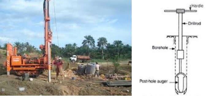
Fig.1: Drilling Boreholes to Take Soil Samples for Assessment of Soil Condition
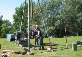
Fig.2: Drilling Borehole
What are the Errors in Borehole Data Interpretation?
Misinterpretations of boreholes include:
- Interpreting folded strata as straight strata
- Drift underlain by unexplored rock
- Overloading due to lack of dip assessment
- Bedrock misinterpretation
- Improper interpretation of strata formation
- Misinterpretation of soil profile
Interpreting Folded Strata as Straight Strata
This type of error is made due to borehole distribution. In this situation, borehole data tells straight strata and other interpretation cannot be made based on that number and layout of the boreholes. This situation is demonstrated in Figure-3 and Figure-4.
This type of error could lead to increase in cost of foundation construction when piles with specified length do not reach soil layer with adequate bearing capacity and consequently the pile length should be increased.
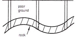
Fig.3: Actual strata shape, all boreholes provide the same data at the same depth
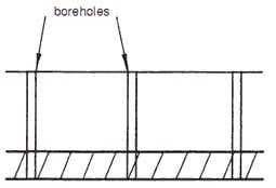
Fig.4: Unrealistic Assumption of Strata Formation
Drift Underlain by Unexplored Rock
It is possible that strong layer of soil sits on a low bearing capacity soil layer. For example, layer of clay material overlay layer of chalk as shown in Figure-5. In this case, borehole may not reach chalk layer and clay layer would shows satisfactory strength and consequently appropriate for foundation construction.
But this assumption would be fatally wrong and would lead to not only extend construction period but also increase construction cost. This type of case has been encountered practically and these detrimental effects were encountered.
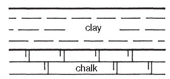
Fig.5: Clay Overlay Chalk
By and large, considerable sink holes quantity would be formed when chalk is present. These holes are usually formed between limestone and chalk joints through which water infiltrate into the ground and reach chalk layer.
Then, the water would dissolve chalk as it travels down and create a shaft. After the water reach chalk material, it might move horizontally and dissolve chalk again and eventually create a cave as can be observed Figure-6.
This is type of error is substantially fatal and should be considered while boreholes are used to investigate soil condition.
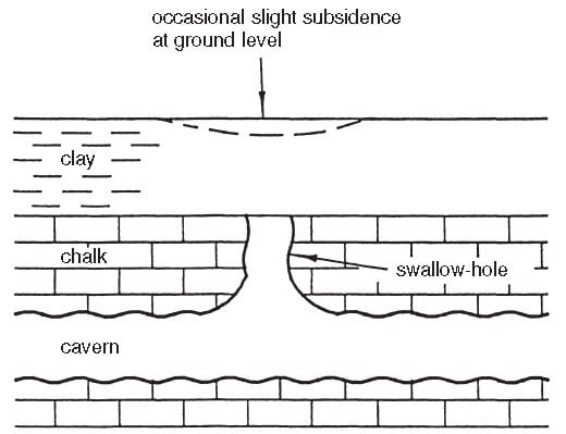
Fig.6: Water infiltrate into the ground at construction site, created swallow hole and subsequent shaft, then the water moved horizontally and dissolved chalk and finally produced a cave which considerably deteriorate foundation
Overloading Due to Lack of Dip Assessment
Occasionally, foundations would be subjected to a load that is out of expectation due to unexamined dip in the construction area.
So, it is recommended to check any dips if existing, to prevent foundation overloading and subsequent failure. Figure-6 illustrates the case where retaining wall structure subjected to extra load.
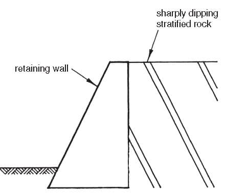
Fig.7: The existing dip has not been assessed, as a result, extra loads are imposed for which the retaining wall has not been designed
Bedrock Misinterpretation
Making errors in the interpretation of bedrock is possible. This might occur when borehole machine reach boulders in boulder clay and consequently bedrock would be assumed wrongly.
This type of errors is illustrated in Figure-8, which shows realistic soil profile and Figure-9 that shows improper interpretation of soil profile. This problem could be avoided by drilling higher number of boreholes.
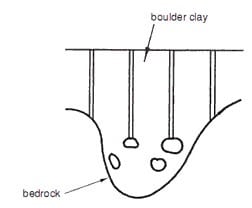
Fig.8: True Soil Profile, Boreholes Reach Boulders
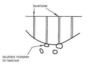
Fig.9: Wrong Interpretation of Bedrock due to Boulders in Clay
Improper Interpretation of Strata Formation
This error might encounter when there is a fault in the area and is not examined. Consequently, strata formation generated would not represent the actual strata as it explained in Figure 10 and Figure 11.
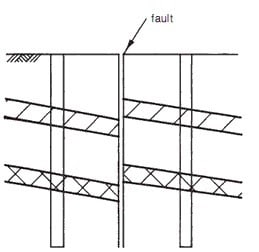
Fig.10: Realistic Formation of Strata
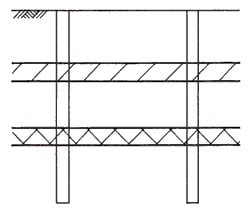
Fig.11: Interpreted strata formation which is considerably different from the realistic one shown in figure 4
Misinterpretation of Soil Profile
It is possible to interpret soil profile wrongly due to small number of boreholes or poor borehole layout. Figure-12 shows misinterpreted soil profile and actual soil profile are shown in Figure-13.
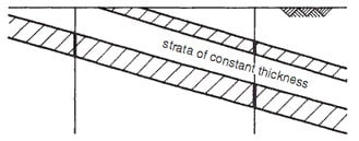
Fig.12: Misinterpreted Soil Profile
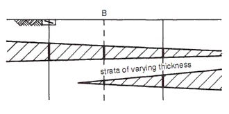
Fig.13: Actual soil profile that interpreted corrected because of digging borehole at (B)
The above possible errors should be considered while boreholes are used for soil investigations. As it has been pointed out, some of the errors could be prevented by increasing the frequency of boreholes.
One might argue that this would increase the cost of the construction but the increase is not proportional.
Added to that, it might not be necessary to test every sample which are taken and if poor bearing capacity soil layer is laid above strong soil layer, then it would not be necessary to assess low bearing capacity soil layer when pile foundation is considered.

No comments:
Post a Comment